Client Side, Server Side, API
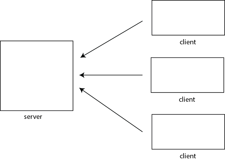
- Client-Server model
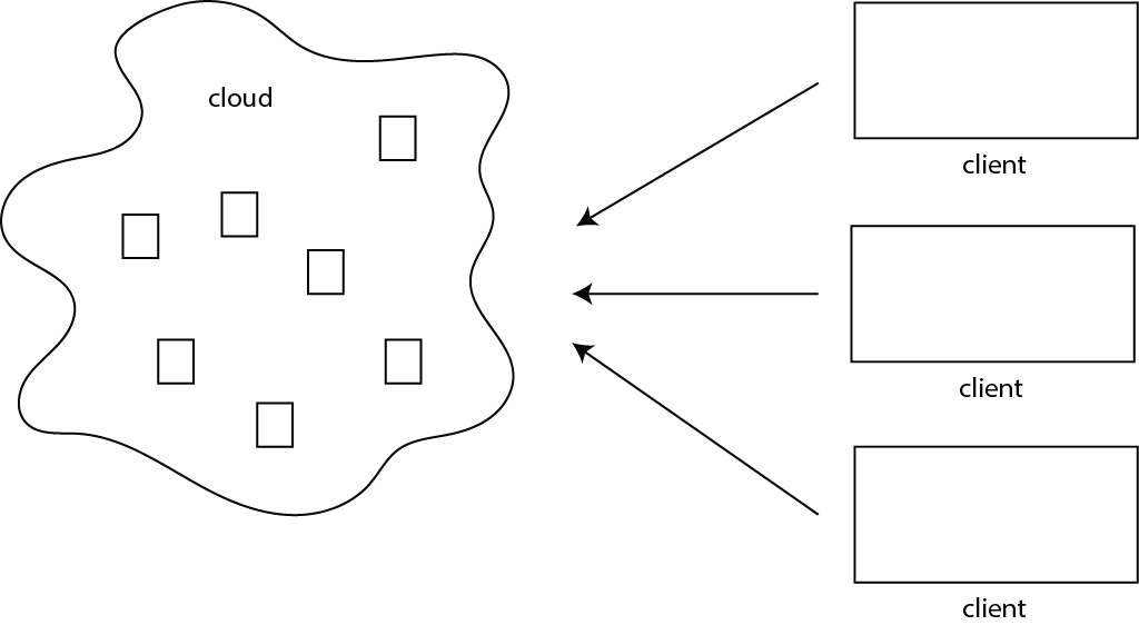
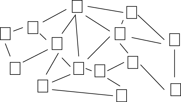
As opposed to.... P2P
- Client side programming:
What we've been doing. The code/text gets fetched from the server. It is interpreted/executed on the client (browswer)

- Server Side programming:
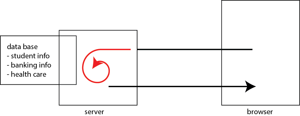
Commong configuration:
- Database (MySQL)
- Web Server (Apache)
- Serverside Scripting (PHP)
- MAMP for Mac (packages that comes with all three)
Server side scripting languages/environments:
- PHP tutorial
- Ruby, Java, c#, javascript....
- What we've been doing is to fetch an html document from the server to get a JSON object. There are other ways to communicate to your/other servers.
For example, using low level functions to communicate to server
Textbook Chapter 13 (Introduction to Ajax)
- .load(); // load an HTML from a server
- .get(url, data, callback) // GET method (send and recieves data. Call callback function once complete)
- .post(url, data, callback) // POST method (send and recieves data. Call callback function once complete)
- .getJSON() // GET JSON
- example of a request to a reddit server. If you take a look at the developer tools console, you will see the content of the json object (named data)
With low-level functions you need to:
- Figure out how to construct a request specific to the services provided by the server
- Figure out how to make sense of the response (eg. XML, JSON)

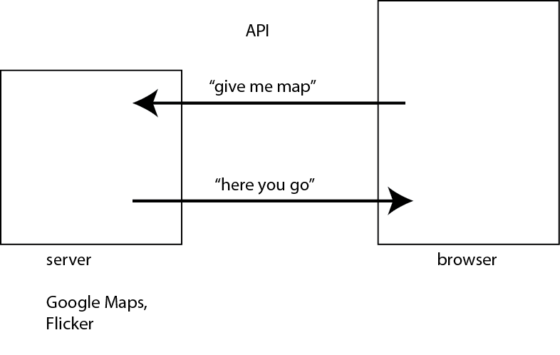
- API:
I should add that things are not that simple for many servers that require authentication. Twitter, for example, requires requests to be authenticated. That forces you to do server side programming (authenticate to Twitter from your server - you don't want passwords to be embedded in your HTML pages)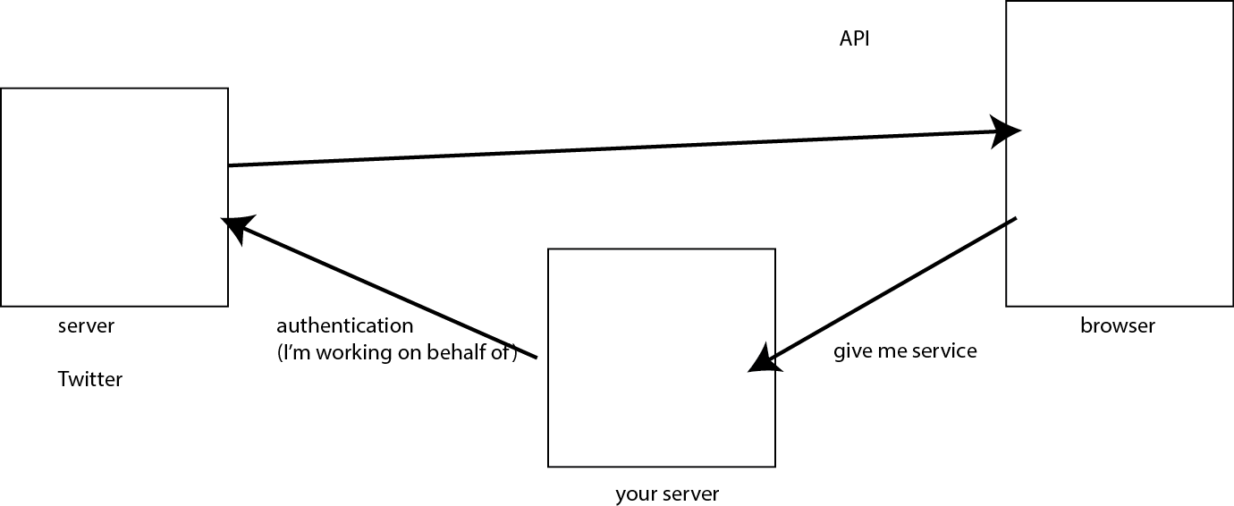
Notes